Discharge time series provide essential information for most water resources management decisions. Streamflow, however, is a difficult variable to measure on a continuous basis. We therefore measure water levels and convert these levels into discharge using a rating curve. More on that later.
There are several instruments for measuring water levels. The instrument of choice is a non-contact sensor such as a radar because of its durability and ease of installation. But using a radar is not always possible. In that case you are left with a shaft encoder, a pressure transducer, or a bubbler.
The feasibility of a shaft encoder is mostly determined by the existence of a functioning stilling well. The choice between a bubbler and a (vented) pressure transducer is less clear.
Both instruments perform well in perennial rivers. However, a pressure transducer can be problematic in an intermittent or ephemeral river. The pressure sensor and vent tube and integrated cable are all exposed when the river is dry and are vulnerable to (opportunistic) vandalism, debris, animals, or accidental damage.
By contrast, the pressure sensor for the bubbler is inside the metal enclosure and is well protected. Bubbler systems determine water level by measuring the pressure required to force air through a submerged tube. The tube is a small polytube with a diameter of less than a centimeter. Hence the air flow rate is small—just enough to prevent water from backing up into the tube. The air emerges as bubbles—hence the name. Modern bubblers have auto-purge systems to prevent sediment from clogging the orifice.
The only element of a bubbler system that is exposed in a dry riverbed is the small polytube, which is normally placed in a conduit. It is inexpensive to replace if damaged, stolen, or washed away. What is required is a solid benchmark on the riverbank to ensure that water levels are properly referenced when the system is reestablished.
The bubbler setup has another advantage. The low flow channel of an ephemeral river is rarely stable. It is quite easy to adjust the polytube in case of a dynamic channel. By contrast, reinstalling the pressure sensor (and vent-tube and cable) because of a mobile channel is a much bigger operation. The bubbler, therefore, is the instrument of choice for ephemeral and intermittent rivers.
Nevertheless, the higher power consumption of the bubbler—because of the air pump—can be a disadvantage in certain circumstances, specifically for remote stations where vandalism is an acute concern, and all instruments are best hidden in a steel pipe or another inconspicuous enclosure. So, there remains a trade-off.
| The Rating Curve The rating model is the relation between water level and discharge at a control section. It is based on the premise that water level is a reliable indicator of flow area and flow velocity, which together make up discharge. Developing the rating model—usually referred to as rating curve—requires accurate discharge measurements. Improving the quality of the rating curve is often the most effective step to improve the quality of discharge time series. |
The Rating Curve
The next challenge is to develop an accurate—and stable—rating curve.
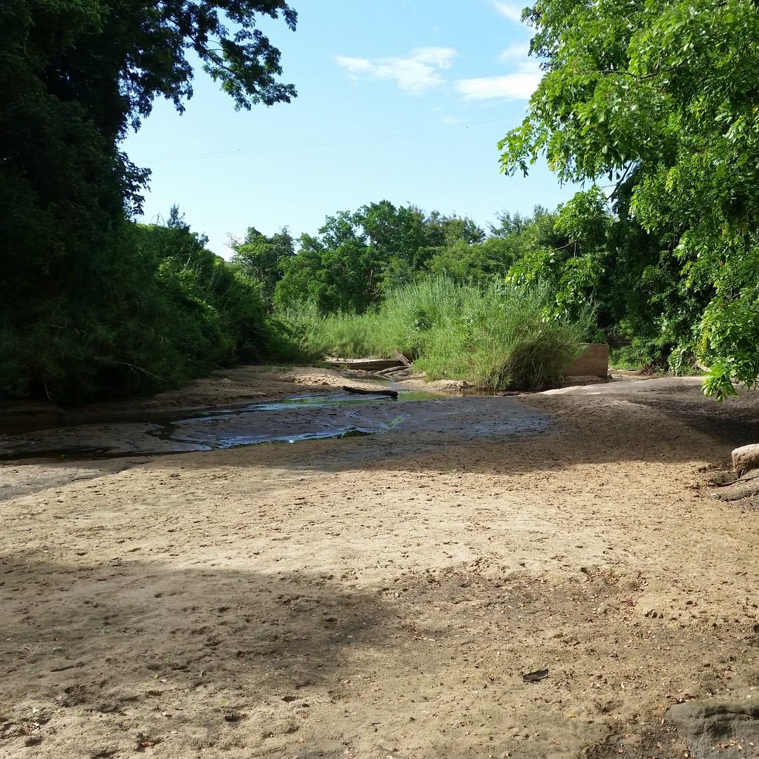
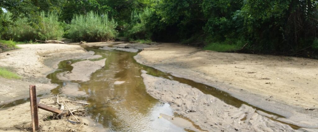
Developing an accurate rating curve for an intermittent or ephemeral river is often difficult. These types of rivers mostly occur in arid and semi-arid regions and are commonly subject to significant sediment deposition or erosion, depending on where you are in the landscape. While an intermittent river usually has a well-defined channel, this is not the case for an ephemeral river that mostly relies on storm runoff and does not have a clear channel. In both cases, the channel is rarely stable. This is specifically the case for the low flow channel.
In addition, given the flashy nature of these types of rivers, it is difficult to be on-site during flood flows and there are normally not enough discharge data points for developing a credible rating curve.
What to do?
Site location is key. Avoid locations where the river leaves the foothills and enters the alluvial plain since this river segment is subject to excessive sedimentation. Look for a site that still has adequate slope with low sedimentation where a bridge—or rock outcroppings—has stabilized the mid and high-flow segment of the channel, and thus the rating curve. If funds are available, stabilize the low-flow channel with a (very) low check dam, probably made from gabions or a geo-tube. This structure should be small and not obstruct mid and high flows. Rather, it should submerge almost immediately when water levels rise.
When a bridge is not available, look for a paved (concrete) river crossing. It will at least stabilize the low flow segment of the rating curve.
The next step is to adopt the hydraulic approach to rating curve development. This robust conceptual methodology is based on the hydraulic characteristics of the control section. Field observations of channel properties suggest the shape of the rating model and provide clues for the coefficients of the standard rating equation. Discharge measurements are then used to validate and calibrate the conceptual rating model. In many cases, a limited number of data points is sufficient to confirm the model.
This approach produces a defensible rating curve that corresponds with the hydraulics of the river. Moreover, extrapolation is justified for the range explained by the conceptual model, which is typically beyond the maximum discharge measured.
In some cases, the rating model can be inferred—with some degree of confidence—for periods without discharge measurements by analyzing channel behavior and the hydraulic characteristics of the control section. Appropriate caution is advised when using the resulting discharge time series. Nevertheless, it will result in a better understanding of the hydrological processes.
Rating Curve Series
This post is part of a series on hydrometry and rating curve development:
- Better Water Data by Stabilizing the Low Flow Control
- Distinct Rating Types: An Example for a Middle Reach of a River
- The Fast Lane to Better Water Data
- An Effective Approach to Improve the Quality of Streamflow Data
- Forensic Hydrology: Recovering 40 Years of Streamflow Data